The little village of Menikkadawara is considered so insignificant that today it does not even appear on a map of Sri Lanka. to reach it, one needs to make a right turn at Nelundeniya on the Colombo-Kandy road (assuming one is driving from Colombo) and travel about 7 kilometers or so. Behind the Menikkadawara post office are several raised mounds of earth, now overgrown with scrub. The sorry frame of an archeological dept board can be found across the road, the only indication that this location has some historical significance.
During the fluid and turbulent times that marked the Portuguese period in Sri Lankan history Menikkadawara was a major military cantonment occupied by the Portuguese. It appears that at any given time the site was manned by 200 to 350 Portuguese troops and up to a couple of thousand lascorines. Being close to the Kandyan Kingdoms western boundaries Menikkadawara was an ideal staging point for probing incursions in to the hill country. The histories of the period indicate that its significance was such that almost every time the Kandyan Sinhalese sallied out into the lowlands if the advance was across the western edge of the kingdom Menikkadawara would be reduced en route ! It is perhaps this regular attention paid to the location that led to the Portuguese to mainly depend on earthen ramparts for the central hub of the defensive complex.
The entire area is surrounded by a ring of moderate hills ranging to about 500 feet. These would have probably provided a defensive perimeter on which lookouts could be posted perhaps even with a cannon or two. That the Menikkadawara area was a cantonment around the central fort is clear from the place names and local knowledge in the area. About 3/4 km from the remains of the earth ramparts is a land called 'Palliye-watte' (Land of the Church) and another land is called 'Shala-watte' (Land of the Hall). Local knowledge indicates that these two locations were the sites of the cantonment church and 'great' hall respectively. The church being a place of worship for the catholic Portuguese and local converts and the hall which served as a meeting place for colonial officials and legal proceedings.
 |
| Looking north from the centre of the ruined fortification |
 |
| The centre of the original fort is relatively level with the edges falling away with what can be identified as outlines of the original earth ramparts. On the upper left the roof of a building can be discerned - this is one of a line of buildings which shield the location from the narrow road running through the Menikkadawara village. The post office which serves as one access point is another building in this row. |
 |
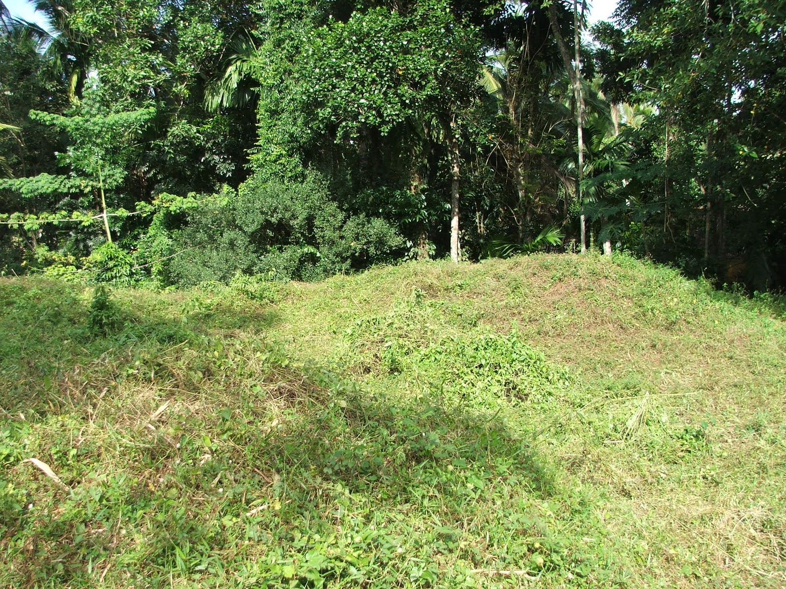
| These mounds are the outlines of the old earth ramparts. The upper edges seen here are about 15 to 20 feet above ground level. It is likely that they would have originally been higher and perhaps reinforced with some brick/stonework. |
 |
| More views of the rampart outlines |
 |
| This view also shows part of the high ground that surrounds the location in the background. The high ground ringing the cantonment would have allowed pickets to be posted to give warning of any hostile force approaching the fort. |
 |
| The government post-office at Menikkadawara. The site of the fort ruins are behind the line of small buildings which include this post office. |